Gaza
Israel's map site showed northern Gaza's ruins, then blurred them again
Graphic: Times of Palestine
Original Reporting
The Newsdesk gathers reporting from wire services and primary sources and rewrites every story in-house before publication. How our journalism is made →
For a few days this week Israel's official mapping portal showed northern Gaza at a sharpness no commercial satellite operator is allowed to sell over Palestine. By Thursday the blur was going back on.
Before it did, an analyst copied the whole layer. Nathan Ruser, who works on satellite imagery at the Australian Strategic Policy Institute in Canberra, wrote on X on Thursday that govmap had "now removed this imagery from its map platform," and published his archive of it through Soar Atlas, a public map-hosting service.
"Here it is, in the full original resolution," he wrote. "The fidelity of aerial imagery really highlights the complete destruction."
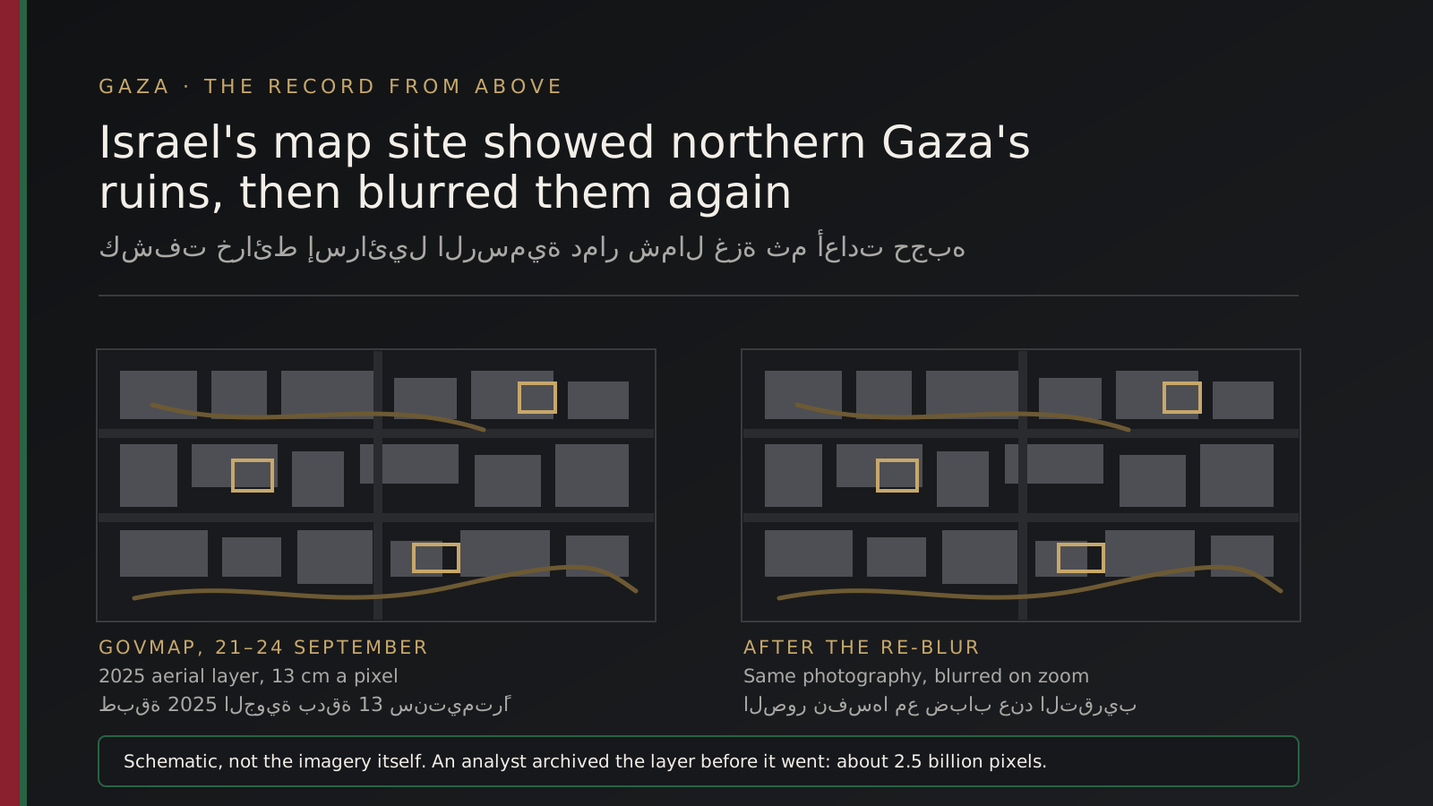
He had explained the copying in an earlier post, when the pictures were still live. He said he had scraped and exported all of it — "around 2.5 billion pixels at 13cm resolution."
for safe keeping, in case they decide to take this imagery offline
Nathan Ruser, Australian Strategic Policy Institute, on why he archived the govmap layer
The Times of Israel's military correspondent, Emanuel Fabian, reported on Thursday evening that govmap had "partially re-blurred" the northern Gaza sections. The same high-resolution photography is still loaded on the site, he wrote, but a blur now appears when a user zooms in.
What the pictures showed#
The site's standing policy blurs the whole of the Gaza Strip up to the Israeli perimeter fence, along with military bases and sensitive locations inside Israel and the occupied West Bank, the Times of Israel reported on 21 September. The 2025 imagery that surfaced this month left a northern and eastern band uncensored, running from the edge of Gaza City to Beit Lahiya.
Inside that band were at least 11 Israeli army positions in the buffer zone the military holds, the paper reported. The strip sits within the yellow line, the boundary Israeli forces have stayed behind since the October 2025 ceasefire, covering roughly 53 per cent of Gaza.
Mohammed al-Za'anin, reading the imagery for Al Jazeera on 21 September, catalogued what was legible in it. At Beit Hanoun, in the far north, he described a near-total sweep of the residential quarters and wide bulldozing of the town's infrastructure.
In Shujaiya, east of Gaza City, he recorded violent destruction across the housing blocks, with deep bulldozer tracks and newly cut roads. Southeast of Zeitoun, the frames showed Israeli deployment inside the Karni crossing area, which he described as an artery for ground operations during the war.
East of Jabalia the imagery showed newly established positions and earth berms raised to shelter armoured vehicles. Further north it showed artillery emplacements, the vehicles parked inside dirt fortifications, and east of Tuffah a main army post with soldiers' tents, a communications tower and equipment.
Al Jazeera cautioned that these positions have shifted repeatedly over recent months, so 2025 photographs do not necessarily show where the army stands today, while the scale of the destruction and the engineering pattern of the deployment broadly still hold.
Sharper than any satellite may legally sell#
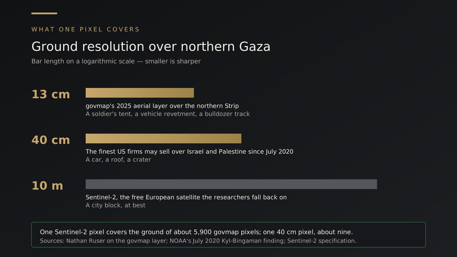
What made the layer valuable is arithmetic. Ruser put its ground resolution at 13 centimetres a pixel.
Under the Kyl-Bingaman amendment, written into the United States defence authorisation act for 1997, American commercial operators may not distribute imagery of Israel and the Palestinian territories at a finer resolution than foreign competitors already offer.
The Commerce Department's National Oceanic and Atmospheric Administration held that ceiling at two metres for more than two decades, then lowered it to 40 centimetres in July 2020. Israel is the only country for which US firms carry such a standing limit.
The free alternatives are coarser again, which is why the northern Strip has been the hardest part of Gaza to read from above.
"The biggest difficulty when working with Gaza OSINT has been the lack of high-resolution photographs over the northern portion of the Strip," the open-source researcher who first noticed the change, who posts as Stinky, told the Times of Israel. The European Commission's Sentinel-2 imagery is "very low resolution," the researcher said, and Google Maps has refreshed high-resolution coverage only over parts of southern and central Gaza.
The archive#
Soar Atlas carries maps and imagery uploaded by its users, and the address of the page Ruser linked describes its contents as a full archive of the 2025 govmap aerial imagery of northern Gaza. He thanked the service for hosting it.
His stated reason for copying the layer is the one archivists give for any record held on someone else's server. A publisher who can put a photograph up can take it down, and the material that documents a place can disappear faster than the place is rebuilt.
What govmap and the army said#
A govmap representative told the Times of Israel on Wednesday that all of the site's imagery is published "in accordance with relevant guidelines and approvals," and that the site would "examine it with the authorized authorities" following the paper's inquiry.
The Israeli army told the same paper it was looking into the imagery. Neither answer said whether the uncensoring was a decision or an error, and the Times of Israel reported on 21 September that it remained unclear which.
Why a photograph of the north matters now#
The military positions are what set the Israeli inquiry running. For readers in Gaza the other half of the frame is the point: the towns underneath.
Al Jazeera, citing the government media office in Gaza and United Nations reporting, puts the toll since October 2023 at more than 73,000 Palestinians killed and more than 174,000 wounded, with about 90 per cent of the Strip's infrastructure destroyed.
UNOSAT's comprehensive damage assessment of 11 October 2025 counted 123,464 destroyed structures in Gaza and 198,273 affected in all, roughly 81 per cent of every structure in the territory. The satellite centre recorded Gaza and North Gaza as the two governorates with the largest increases since its July 2025 count, and described the analysis as preliminary and not yet validated on the ground.
Those are counts. What briefly sat on govmap was a photograph, at a resolution the public has never had over the north, of what the counts describe.
Whether the layer is restored, kept blurred or taken down is a decision for the Israeli authorities the site named. The copy Ruser published is not theirs to make.